AreaMap-Lite app for iPhone and iPad
Developer: Antonino DAngelo
First release : 21 Oct 2011
App size: 219.43 Kb
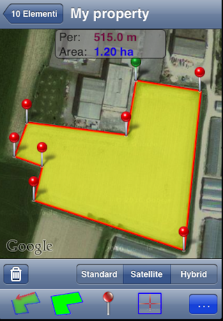
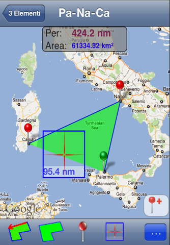
AreaMap-Lite allows you to measure the perimeter and the area of anything is visible on Googl.Maps.
This app is the free version of AreaMap-Pro, and then allows you to test out his duties without spending a dollar.
This app is designed to measure plots of land visible from satellite maps.
Just move your finger on the "viewfinder" that appears on the map and add the PIN that delimit the land.
Will be calculated in real time, the distance between the added pin and the above, the perimeter and area.
You can move the map left holding the viewfinder and add the same pins.
It can be used to measure industrial areas, halls, gardens, parks, race tracks, length of roads, all that is visible on Googl.Maps.
Each measure is added to a table, which can be saved.
Characteristic parameters:
* iOS 5 Ready
* Languages: ITALIAN, ENGLISH, FRENCH
* Table: add, edit, delete items
* Map Display: Standard, Satellite, Hybrid
* PIN: add, delete, move, rename
* Position: Latitude and Longitude of each pin
* Length: meters, kilometers, yards, nautical miles
* Area: square meters, hectares, square kilometers, acres
* Line Colors: red, blue, green, yellow, magenta, black
* Area Colors: red, blue, green, yellow, magenta, black
* Viewfinder: On / Off
* Area: On / Off
* Pin: On / Off
* Top panel: shifts automatically, depending on the viewfinder
* Table items measured: No limit *** (Pro version only) ***
* Pin Number: No Limit *** (Pro version only) ***
In the Lite version:
* Maximum 5 (five) Pin to delimit an area
* Maximum 3 (three) elements in the table
* Banner Advertising
***************
AreaMap-Pro is available on the App Store
***************


